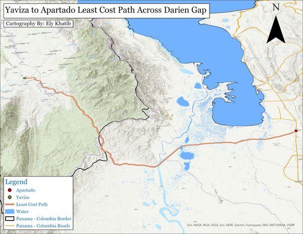
Three Dimensional Cost Pathway Analysis
This is another Cost-Path analysis like the one on the "Cost Path" page, however this is a three-dimensional representation of the mountains and pathway. This map was created using the local scene feature in ArcGIS.

3-D Fire Hazard Map of Santa Cruz
The map displays the fires of Santa Cruz in orange, with red illustrating the cities and boundaries. The yellow points are specified address points and the blue points are important landmark facilities of the given cities.
Unlike the map above, the image to the right was created in QGIS. Using the html file, this can be an interactive three-dimensional map as well.

Interactive Web Map of CA Fire Zones
This map contains information about the fire hazard zones and firefighting responsible entities of California as it relates to California counties, cities, and public schools. One can see areas of moderate, high, and extremely high fire hazards and where their city or school of interest falls within these zones. This is also useful for those interested in learning about county populations and population densities with overlapping knowledge of fire hazard zone cover. Schools can be categorized as elementary, elementary-high school combination, or simply high schools. Responsible entities are labeled one of the following: LRA for Local Responsibility Area, SRA for State Responsibility Area, and FRA for Federal Responsibility Area.