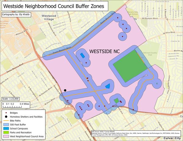
Buffers Around Various Feature Layers
The image to the left is of dissolved buffer zones around polygons, polylines, and point features. There is a law that homeless people cannot sleep within 500 feet of bike paths, bridges, schools, and parks. This project aimed to visualize and numerically understand both the area of this coverage and area leftover within the city. Homeless shelters are also displayed.
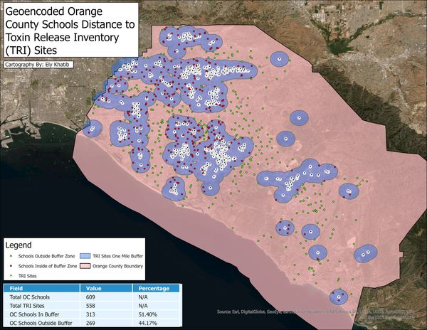
Buffer Statistics Around Points
The image to the right is of a one mile buffer zone around Toxin Release Inventory (TRI) Sites in Orange County, along with schools as points. Green points illustrate schools outside of TRI site buffers, and red points are those schools that intersect the buffer zone. Embedded in the map is a table containing statistics about the numbers/percentages of the schools and buffer zones.