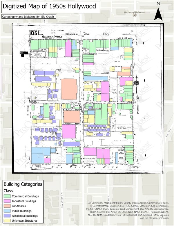
Digitized Map of Hollywood Block
To the left is a digitized map of old Hollywood. Digitizing is the process by which a map is traced over to create shapefiles that can be used for further analysis. Polygons, polylines, and points can all be created, categorized, and edited using the attribute tables.

Raster Georeferenced Map
The image to the right is a georeferenced my of Old Riverside overlayed on a satellite image of the same area. The process of georeferencing includes taking a map (sometimes hand-drawn) that has no locational data, and pinning points of it to real locations using a basemap for reference. Now one can see the characteristics of both the hand-drawn map and the real-life images in the basemap.