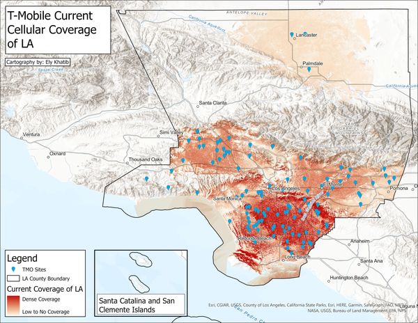
General Viewshed Analysis
Viewshed analysis is a technique in which GIS calculates the visible reach of a point value based on its range, height, and local elevation properties that may interfere. One can also use this tool to calculate the numerical area covered or uncovered.
The image itself displays the covered and visible area of T-Mobile cellular towers in LA County. This makes it easy to visualize where one will get strong, weak, or no cellular connection within LA.
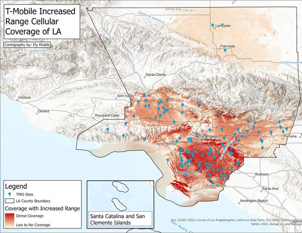
Editing Features within Viewshed Tool
Inside of the Viewshed Analysis tool, one can change various characteristics and run the calculation again in order to understand any changes in the viewshed. This allows us to understand the next steps when trying to expand coverage or visibility. In the image to the right, the range value of cellular towers was increased and the viewshed was recalculated to see whether investing in range has a more significant impact as opposed to tower height.